Tuesday, March 11, 2014

Street and Nye Mountains

Hike distance: 8 miles round trip
Peaks: Nye (3,890 ft.), Street (4,166 ft.)
Trail Map

There's nothing like the first climb of a new year.  This one came much too far into the new year for my taste, but it finally happened so I'm not complaining.  This time around me and the crew took on two mountains without official trails in the waning weeks of winter.  Going off trail is always a bit unnerving, because, admittedly, none of us are that handy with a compass should we go off trail.  Street and Nye are the easiest of the unmarked mountains though, so we figured this would be a good place to start.  The trail head is at the Adirondack lodge and picks up when the trail up Mt. Jo cuts right.  We ducked left and headed into the unknown.  It was supposed to be a frigid day, but it was unusually warm after our bodies adjusted to the initial shock.  The ice on the trail made for some fun slip and sliding early in the hike.


The frozen Indian Pass Brook

The trail was mostly packed snow, making for a relatively easy hike since we got to skip the hopping from boulder to boulder.  The surprise of being so monstrously warm made us all drenched from our own sweat, despite the temperature being in the teens.  We passed over Indian Pass Brook on top of an ice bridge that formed from one side of the riverbank to the other.  It was so calm and serene, which was ironic given the fact that the brook can be impassable during the spring melt.  We made good time up the trail that was conveniently plowed by the snowshoers who came before us.  We even had time for a goofy pose or two.  It's worth mentioning that I accidentally hit Allie in the face with a chair earlier in the day, and neither she, nor Brian, would let me live it down.  I argue it was a soft chair and she was fine after the shock of impact.  As proof:


Brian navigating a steep section
The fork for the two mountains is in a clearing that is marked clearly on a tree bearing the etchings of which way to go.  Nye, famously, is the second shortest of the "High Peaks".  Inaccurate measurements placed the peak at 4,000 feet, when it doesn't even break the 3,900 foot mark.  It remains on the list of High Peaks for old times sake, but it is a wooded summit with practically no views.  We choose Nye first to get it out of the way.  It is very close to the fork and took no time to get to.


Street was our final destination for the day, our 25th mountain, and had much better views than its sister peak.  After the customary summit dance and gnawing on frozen jerky and protein bars, we took in the best sights of the day.


Thursday, March 6, 2014

Cascade and Porter

Peaks: Cascade and Porter
Distance: 4.7
Trail Map

Hiking in the winter adds an entirely different dynamic to climbing, particularly if there is a lot of snow and wind.  This was our second hike in winter conditions, but the previous one up Phelps was early enough in the season that it didn't get truly wintery until the last half mile.  We wouldn't be so lucky this time.  Just driving to the trailhead involved a 5 hour cruise through near whiteout conditions.  Brian and I we're considerate enough to fall asleep in the car and allow Allie to drive through the blizzard in solitude (insert sarcasm, she wasn't happy).  After a brave drive it was time for a brave hike.  Barley able to see the cars headed down the road, we jumped onto the trail and made haste.

Blizzard pose

Cascade and Porter are considered the easiest climbs in the ADKs.  The trail is one of the shortest and the views are very rewarding considering Cascade is almost completely bald.  What you don't hear is how the trail gains thousands of feet in altitude in that very short hike.  It was by no means hard, but the gail force winds that day made for frigid hiking at the exposed sections.  Without snowshoes or microspikes even, we made it to the outskirts of Cascade's summit in quick time.  Feeling good about ourselves, we dropped our packs where the snowpack ended and made our way to the rocks to take in our first winter view.  The wind had other ideas.


The portal to Cascade's summit
The day had partial visibility, making for a sublime panorama.  The winds at this point were gusting well over 80 mph.  You could lean back as if in an armchair and have the wind hold your weight for a few seconds.  The virtual skating rink that encased the rocks made for a pretty easy form of transport, just put out your arms and let the wind slide you across.  It was a thrilling experience, even though we all got pinned to the side of the mountain on several occasions, unable to move or even look up.  As we turned to leave after snapping a few shots, a gust came down so ferociously that every hiker on the summit simultaneously ducked so they would not be blown over.  It was some of the most fun I've had climbing before, but it was brutal, painfully so.

Allie holding pinned by a hurricane gust

The rare NY Grizzly Bear atop Porter
The climb over to and up Porter was quick, but chilly after the ice blasting we got on Cascade.  We celebrated our second peak of the day, took a few more shots, huddled for warmth and then got the hell out of there.  Despite the periodic pain from the cold, this was one of my favorite climbs.  I also learned a great remedy for the cold in our post-climb downtime: hot cider and carmel vodka.  In the words of Sylvia Plath, “I began to think vodka was my drink at last. It didn’t taste like anything, but it went straight down into my stomach like a sword swallowers’ sword and made me feel powerful and godlike."

Giant Mountain and Rocky Peak Ridge

Peaks: Giant Mountain and Rocky Peak Ridge
Distance: ~11 Miles
Trail Map


If you've read my hiking stories long enough, you've probably been introduced to my Bears, Allie and Brian, but you might not have met my Gator.  One of my best friends/practically family is named Patrick, but through a series of comedic events he has been dubbed Gator Boy, or GB for short.  GB is the consummate outdoors man, with big dreams of attending the NOLS wilderness education school and landing a job in the outdoors.  These days he lives in Indiana so I only get to see him back out East so often.  One summer visit he wanted to take on some high peaks, thus begins our climbs of Giant and RPR.

The Friendly Campground Cat

We drove up to the High Peaks region the evening before, after a full afternoon of boozing on another friend's boat.  Brian was wheel-man while the crew tried to sober up on the ride.  Needless to say, we slept well.  A fourth friend, Julian, also accompanied us on the trip.  The last time I saw Julian he was skinny and got winded a bit easy.  About three years and 10 lbs. of muscle later, Julian could literally run up the mountain if he wanted.  The hike is short enough that we were able to take our time getting up and play with the fluffy gray cat that patrolled the campgrounds.  We made our way down route 73 where an oddly enormous sign marked the parking lot and trail head from the road.


The ascent was unusually easy for a good many miles.  It was a surprise given the stature of the mountains.  Giant earns its name due to its relative isolation from other peaks combined with its enormous width and considerable height.  The peak looms over the town of Keene Valley below, making an ominous shadow at the right time of day.  We moved through the woods at a considerable pace until the worst happend, I uttered the words "This is a joke!"  Almost immediatley thereafter, as if on cue, the gentle and gradual ascent of the trail gave way to endless rock scrambles; "Hello foot.  Meet mouth!"  I wasn't upset, I love to scramble, but God was it a hot and sticky day.  It was the type of day where your vision was blurred by the sweat rolling down your face and into your eyes.  The trail levels out and you have the option to cut right and head to RPR, or cut left, up a rock wall, and bag Giant.  It was about a mile either way.  We opted for Giant, not realizing we could even hike two peaks in one day; we hadn't quite got the whole peak bagging thing down.

GB
Right before the split we met a girl in her mid-20's, covered in dirt, with a yellow bandanna who could unleash more words per minute than any human being possibly should or be able to.  After a barrage of needless anecdotes, she informed us she was going to bag both mountains, that it was the sensible thing to do, and even implied in her tone that we were fools or lazy for not considering it.  We bid her adieu by silently kicking the air a few feet from her behind as she turned to climb Rocky.  The summit of Giant was crowded, as is expected in the summer due to the easy accessibility of the trail head to the road.  The four of us could have stayed there all day, chatting with veteran 46ers who were up there for their 3rd or 4th time.  There was also a group of hikers from Canada who were apart of a club that seeks to hike every mountain above 4,000 feet in the Northeast, all 111 of them!  The crystal day was turning a bit grim in the distance, but we figured we were looking far away given our altitude.  After a little coaxing I talked the crew into taking on RPR too.  Not too long after leaving the summit we came across our ripe smelling friend who offered the advice to hike Giant and RPR in tandem in the first place.  Apparently she got to the bottom of the col between the mountain and realized she was too tired to take them both, so she made her way back up to Giant.  I felt bad, but the irony was too much not to let out an internal chuckle.  


We set off for RPR, which was separated from Giant by a col that dipped before abruptly climbing again.  We got there in no time and made a few more friends while taking in the view.  We may have been building as hikers, but definitely not meteorologists.  The sky was outright black now, pounding the mountains in the distance with torrents of rain we could only imagine.  None of us minded getting wet, but no one had a change of clothes, nor did we want to sit for four hours in a car soaked.  We hustled back down the col, but as we started ascending Giant again, we had to stop so Brian could nurse a pretty bad cramp.  I have no idea how we made it back before the rain, but all hell broke loose a few moments after hitting the car.

Julian feeling like Superman on RPR.
The scared Giant from RPR
RPR from Giant. Look close and see the hikers on top.
This is one of the "easier" climbs in the ADKs with one of the greatest rewards.  The views from Giant are breathtaking, and well worth the sweat and colorful strangers.   

Friday, February 28, 2014

Adirondack High Peaks

The High Peaks are the 46 tallest mountains in the Adirondack Park of the great state of New York.  Originally thought to be the only peaks in the ADKs above 4,000 feet, erroneous measuring placed 4 mountains lower than the 4,000 mark on the list and left one at exactly 4,000 feet off.  The original list remains though and for the climbers that scale all 46 you gain admittance to the coveted 46er Club.

This page (and my 46er quest) are works in progress, so there's not a trip report for each climb yet.  Stay tuned though!


  1. Mount Marcy
  2. Algonquin Peak
  3. Mount Haystack
  4. Mount Skylight
  5. Whiteface
  6. Dix Mountain
  7. Gray Peak
  8. Iroquois
  9. Basin
  10. Gothics
  11. Mount Colden
  12. Giant Mountain
  13. Nippletop
  14. Santanoni Peak
  15. Mount Redfield
  16. Wright Peak
  17. Saddleback Mountain
  18. Panther Peak
  19. Tabletop Mountain
  20. Rocky Peak Ridge
  21. Macomb Mountain
  22. Armstrong
  23. Hough Peak
  24. Seward Mountain
  25. Mount Marshall 
  26. Allen Mountain
  27. Big Slide Mountain
  28. Esther Mountain
  29. Upper Wolfjaw
  30. Lower Wolfjaw
  31. Street Mountain
  32. Phelps Mountain
  33. Mount Donaldson
  34. Seymour Mountain
  35. Sawteeth
  36. Cascade Mountain
  37. South Dix
  38. Porter Mountain
  39. Mount Colvin (Evil!)
  40. Mount Emmons
  41. Dial Mountain
  42. East Dix
  43. Blake Peak
  44. Cliff Mountain
  45. Nye Mountain
  46. Couchsachraga

Big Slide Mountain

Peak: Big Slide
Distance: ~11 Miles
Trail Map


They commonly say that Big Slide has the best views in all of the ADKs, but at the time I started the hike I didn't give a damn.  Brian (aka Grizzly) and I set out that day to take on the third highest mountain the ADKs, Haystack.  When we arrived and passed a friendly Park Ranger who asked where we were headed he gave us a grim look and even grimmer news.  "You're pretty late in the day for Haystack!" he exclaimed.  "Do you boys have headlamps?"  Headlamps?!  We had no intention of hiking in the dark.  Luckily, from "The Garden" parking lot in Keene Valley there were plenty of other hiking options.  We opted for Big Slide.  A good choice given the fact Brian had a respatory infection...and was wearing jeans for some unknown reason.


After the first major ascent Brian's respitory infection (and stupid jeans) had caught up with him.  In between wheezing and panting strenuously he uttered the worst words he's ever mumbled in the High Peaks, "I don't think we can do this."  Kowing we'd both be furious if the day eneded there I begged him to make it to the top of the ridge and rest to think.  The ridge was breathtaking and Grizz soon forgot his woes.  It flattened out for a long bit anyway, so it let us take in the views and he could catch his breathe.


The climb up was a bit perplexing, seeing how we just kept making one quad-busting ascent after another and just kept getting nowhere.  The trail we took was called the Three Brothers Trail, little did we know the "brothers" were mountains, two mini subsidiaries and the tallest being Big Slide.  The climb would go from flat to near vertical the entire time.


By the time we got to the top we were a bit exhausted, but had no time to think about it because of our first major encounter with Black Flies, little nat sized vampires that feast on the flesh of the living.  I ate my lunch running in large circles to make it harder to get bit.  Unfortunately the flies were faster and must of have had a taste for dark meat, I got bit about a hundred times.  We took an alternative root down for some new scenery, this time the John Brooks Trail, which probably would have been a lot easier a climb up had we known, but no mind.  I wouldn't have traded those views for anything.


Mount Marcy to the far right and Haystack, our original target, in the center.

The Adirondack Upper Great range

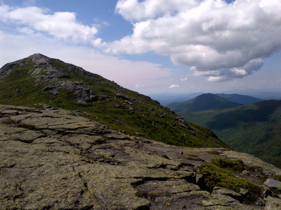
In my humble opinion, this is the best hike in the ADKs.  It's a brutal 20 mile loop that takes the entire day and brings you over three gigantic peaks.  It's a true mountaineers dream, at least for those of those of us out East.  Brian and I started our trek at The Garden parking lot and headed towards Johns Brook Lodge on the Phelps Trail.  The morning was chill, but warming quickly and the air was crisp.  We stumbled into the Lodge just as those staying at the relatively primitive dwelling were lining up for breakfast.  We decided to sit down outside the lodge and have some breakfast of our own, primarily consisting of Cliff and Nutrigrain bars and a bit of Gatorade.

We didn't get the best nights sleep before the hike because our preferred campsite was filled with cyclists who were competing the next day in....something.  After a wild drive that brought us to the shores of Lake Champlain, we sat down to have to have some of the worst pizza in the state, washed down by water that tasted curiously like a lake.  We strolled through the small town we stumbled upon and got "hollered" at by some less than lovely young ladies.  I enjoyed it quite a bit, Brian decided to reveal that he has an irrational fear on country folks, even if they were only 19 and hitting on us.  We decided to sleep in Carla.  No, that's not one of the girls, it's my Jeep:


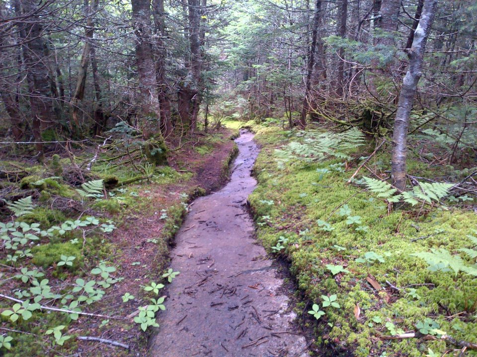
Once on the trail we marched and marched and marched and it never seemed to get any higher, but thats the trick to Haystack, you have to fight just to earn the privilege to start climbing it.  Haystack is one of the more remote mountains in the park, so much so we had never even seen its name on a trail sign while doing one of our other hikes.  When we finally got to the junction for the final push we were confronted with a 40 foot rock scramble that commenced the ascent.  It was one scramble after the next, then up and over Little Haystack, a small subsidiary peak before the main summit.  I had more fun climbing Haystack than any other mountain in the ADKs at the time.  The exposed summit, the endless scrambles, and breathtaking views made me feel like a true climber for once.  At the top we found out why they call this mountain "Marcy's Balcony"; it is the best view of Marcy in the park.  We were on the summit for just a few minuets before a father and daughter joined us, shouting what we have been dreaming of since we started, "46!"
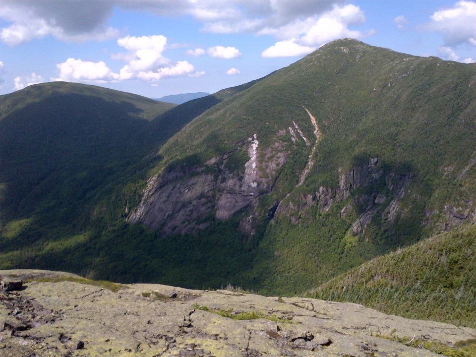
Mount Marcy and Mount Skylight on the Left
Summit of Haystack
We lingered in the crystal clear day only a bit then went on our way.  We could see Basin perfectly from the enormous Haystack, the third tallest peak in the park, falling just short of 5,000 feet.  The ascent up Basin gave us some excellent views of what we just climbed and beyond.  Basin was a much wetter and muddier mountain than the rocky peak we just came from, but who doesn't like it a little dirty?


Haystack in all its glory.
Since Basin is a bit closer to major trails and other peaks its summit was crowded and much louder.  We came across a couple from Montreal who were also on their way to be 46ers, but they had the added bonus of getting engaged that day atop of Marcy.  After giving them a hikers hug (a momentary one-handed press while holding your breathe) we were on our way.  The last and shortest peak of the day was Saddleback.  We hadn't read up on the summit before we left so what we saw next was simply terrifying.  As a rule of thumb, the grade of an ascent (or decent) is hard to figure out at a distance.  Normally in the ADKs, that which looks very steep ends up being pretty mild when you get closer to it.  This was not the case on Saddleback.  The string of hikers on descent looked like they were repelling down a vertical skyscraper and sure enough thats what it felt like when we got there.
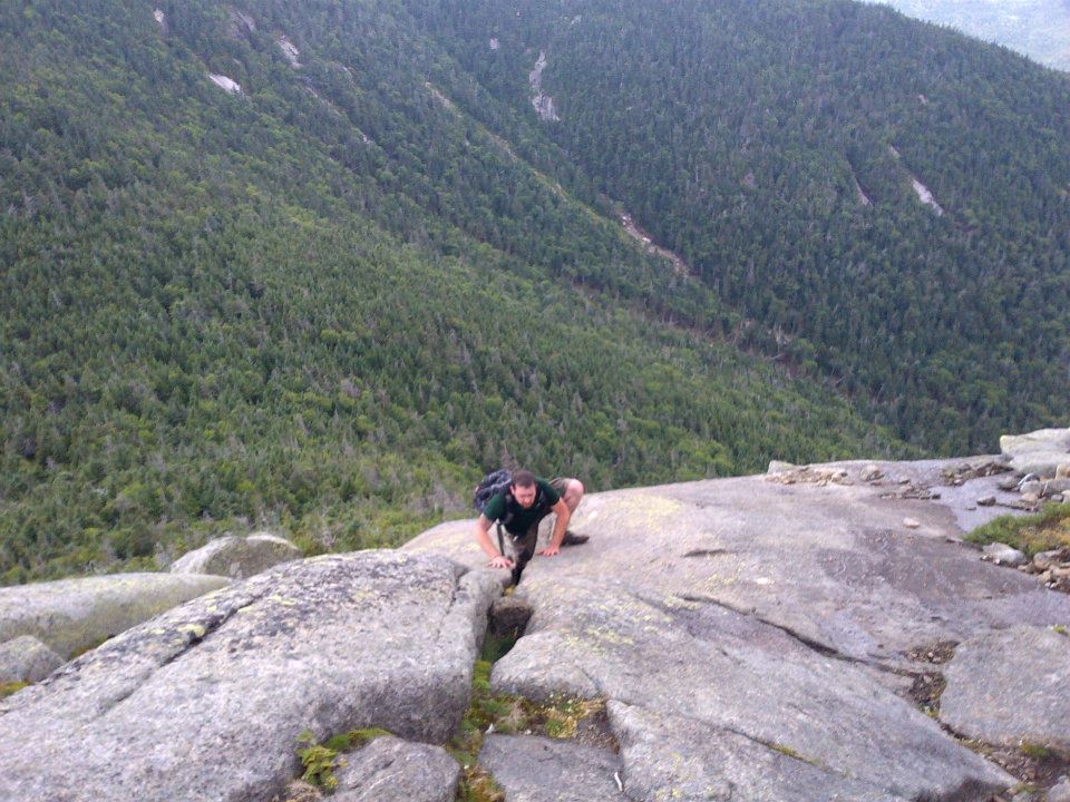
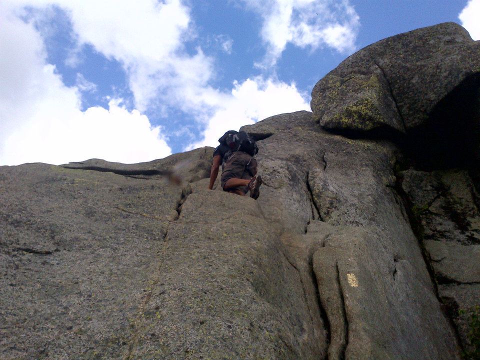

I was in my glory!  I love heights, I love scrambling, and I even love the terror of scaling steep sections. Brian, not so much.  As I was busy finding the most difficult scrambles I could find, Brian (terrified of heights) was genuinely unnerved.  I cooled my jets.  He got to the top and shouted a string of celebratory obscenities (hence the nick-name Grizzly).  Upon decent we came across a massive rock slide from years past that we had some fun running down.  After power hiking it back to the Jeep all we could think of was steak.  It was Brian's turn to pick a place to eat and he picked the Adirondack Steak something, something, across from the Olympic complex....don't ever eat there!  No mind though, we conquered half the Great Range.


The Colorado 14ers

If my quest to be a 46er is a work in progress, then my quest to be a Colorado 14er is a dream about a work in progress.  I've only taken on two 14ers so far and there's a staggering 53 of them.  My greatest outdoor adventure is planned for this summer though, a 100 mile traverse of the Sawatch Range, bagging 14 peaks along the way.  With any luck I'll be a 46er and about a third of the way to being a 14er, so stay tuned!


  1. Mount Elbert
  2. Mount Massive
  3. Mount Harvard
  4. La Plata Peak
  5. Blanca Peak
  6. Uncompahgre Peak
  7. Crestone Peak
  8. Mount Lincoln
  9. Castle Peak
  10. Grays Peak
  11. Mount Antero
  12. Torreys Peak
  13. Quandary Peak
  14. Mount Evans
  15. Longs Peak
  16. Mount Wilson
  17. Mount Shavano 
  18. Mount Princeton 
  19. Mount Belford
  20. Crestone Needle
  21. Mount Yale
  22. Mount Bross
  23. Kit Carson Mountain
  24. Maroon Peak
  25. Tabeguache Peak
  26. Mount Oxford 
  27. Mount Sneffels
  28. Mount Democrat
  29. Capitol Peak
  30. Pikes Peak
  31. Snowmass Mountain
  32. Mount Eolus
  33. Windom Peak
  34. Challenger Point
  35. Mount Columbia 
  36. Missouri Mountain
  37. Humboldt Peak
  38. Mount Bierstadt
  39. Sunlight Peak
  40. Handies Peak
  41. Culebra Peak
  42. Ellingwood Point
  43. Mount Lindsey
  44. Little Bear Peak
  45. Mount Sherman
  46. Redcloud Peak
  47. Pyramid Peak
  48. Wilson Peak
  49. San Luis Peak
  50. Wetterhorn
  51. Mount of the Holy Cross
  52. Huron Peak
  53. Sunshine Peak